
Best Hiking Trails in Crested Butte, The Scenic Teocalli Ridge Loop
Disclosure: When you buy something through the Affiliate product links I have created below, I earn a small commission. I only promote products and companies I support as well as believe in
Crested Butte in the summer is one of the best places to explore different hiking trails. The area has everything from short scenic paths to ten mile plus day hikes with elevation gain that will take you to the top of some awesome overlook areas such as TeoCalli Ridge!. After getting a recommendation from a friend on this hike last minute, I decided to go for it. It wasn’t far from town, so I grabbed breakfast at a local bagel shop in town and then made my way towards the trailhead.
In this post I’ll be going over parking, how to get to the trailhead, details, best time of year to hike it, what makes this trail worth it, and what to expect!
How to get to the trailhead and where should we park
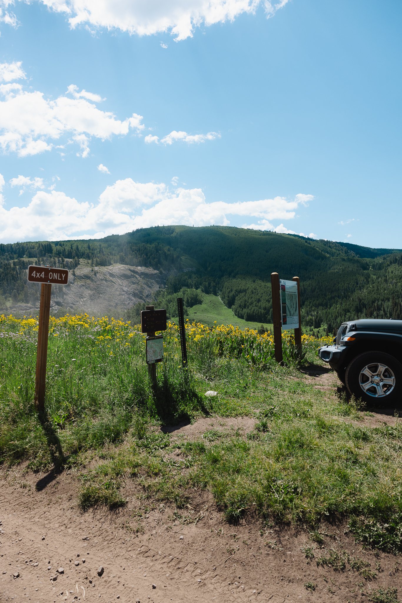
The trailhead is a little over 20 minutes from downtown Crested Butte and you want to end up on Brush Creek Road. You’ll Pass the Brush Creek Trailhead on the left, a more popular hiking destination and the road will turn into Forest Service-7738. These are dirt roads in which you’ll pass a farm and cattle ranch on the way to the trailhead! AWD is helpful, but not required to drive this road. If you do plan on camping in the area, you will need to have a high clearance vehicle with 4 X 4 to make it up the road to designated campsites FYI.
Distance from town: 8 Miles
Coordinates: 38.89614, -106.88932

For parking there will be a few spots at the start of the hike, however if you stay right on the service road and keep driving, you’ll come up on a much bigger parking lot. This is where the hike actually ends if you do the entire loop.

Where does the trail begin and how long is the hike
The trail will start on the dirt road, Forest Service-7738 essentially right where the map and trail signage are. This hike is going to be longer and a bit more challenging then some of the other more popular hikes in Crested Butte, so make sure to plan accordingly! It took me over 6 hours to complete with breaks and shooting photos along the way.
There’s also going to be some elevation gain on this trail, so be prepared to hike up hill a bit for the first half of the hike! It will be worth it though, the views on this hike are incredible on the first half of the trail. Below are some quick trail stas.
Trail type: Loop
Elevation Gain: 2,303:
Distance: 10.9 miles
Dogs Allowed: Yep, this is a more remote hike so if you plan on hiking without a leash, just keep in mind there is wildlife in the area such as moose, bears, and mountain lions.
What should we expect
This hike isn’t easy by any means so if you’re looking for something a little more chill check out the Snodgrass Trail or Lupine trail closer to town. Really, the challenging part is the distance. You’re hiking close to 11 Miles, so take breaks, drink lots of water, pack snacks and just enjoy the trail because it is a good one! Expect the views to be pretty amazing, especially when you get up on the ridge line.

What should we pack
Depends on the time of year, but I listed some items that I highly recommend
Hiking Boots- You can get these at REI or your local outdoor
Rain Jacket- Always pack one of these, especially on longer hikes!
Outdoor Clothing- Try to stay away from anything cotton and stick to performance type clothing when hiking. Outdoor specific brands to look into would be
Fjallraven, Patagonia, and The North Face.Sunscreen- Apply this ahead of time or keep a sunstick on you to reapply throughout the hike if necessary.
Extra Water

Best time of the summer for Wildflowers
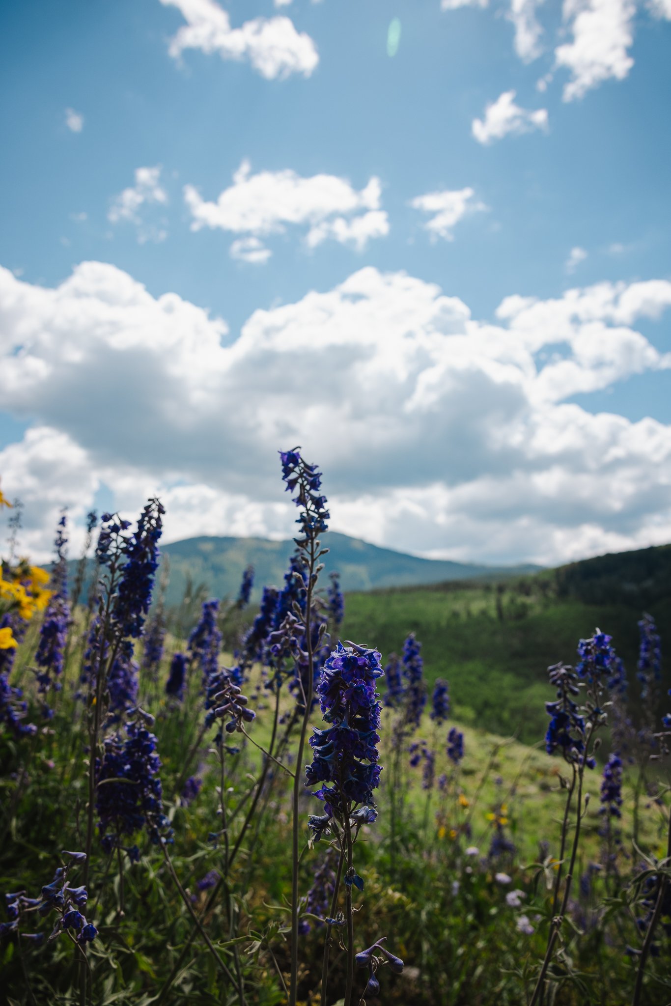
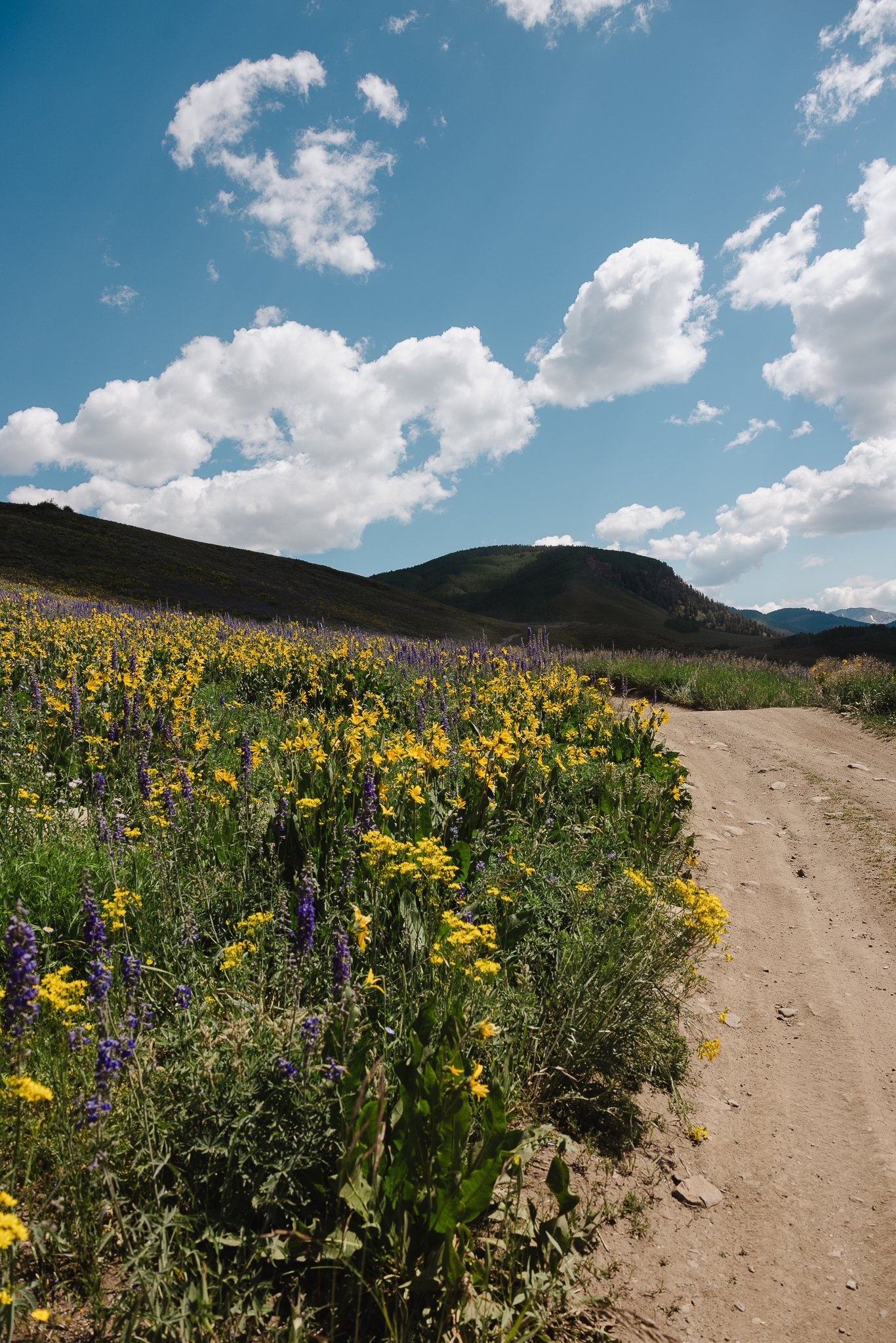
I hiked this trail the second week of July and I feel like that was the last great week of catching the Wildflowers. However, it depends on the year and the start of summer was extremely dry. On average the flowers start to bloom in June and peak at the end of June through early July.
What are some trail details
You’ll start right next to the trailhead sign which is a clockwise route to take. Take in the views as you make your way along the trail. Once at the top of the Forest Service Road, you will have to cross part of the river. This is where having a pre-downloaded map on AllTrails will be helpful. You can either take your shoes/socks off or just trek through the river with your hiking boots on.
Once your across the river, the trail will take you through a small patch of Aspen Trees. This part of the trail is pretty flat, so try to enjoy it!


Eventually you will arrive at the trail sign Teocalli Mountain TR no. 554. The elevation gain starts to kicks in here and you will be hiking across the Ridge with Teocalli Mountain to the left!

The end of Teocalli ridge is one of the best views on the hike in my opinion, so grab a few pictures and take in the view. It overlooks the valley area along with the streams and river below.


The second half of the hike will be mostly through pine trees with no views until you get to almost the end of the hike. As you descend your way down through Aspen trees, be cautious of Mountain Bikers and Dirt Bike Riders! This trail is great for either of those activities.


The end of the hike is nice when it’s wildflower season as you will run into an entire mountainside full of them. As you make your way back to the parking lot, you will have to cross the river one last time to stay on trail.

When is the best time of year to hike Teocalli Ridge
This trail is good, depending on snowfall, from Mid May through October with the best times being early July for Wildflowers and Late September for the Fall colors.


You’ll probably feel pretty accomplished after hiking this trail so pat yourself on the back if you hiked the entire trail. Looking for other outdoor recreation in Colorado? Check out the small town of Buena Vista, with rafting, hiking, and even River Surfing. It is one of my favorite places in Colorado to explore.