
Welcome
I really started The Outdoor Gems to share outdoor experiences through photography and storytelling to inspire more people to get outside. If more people got outdoors; took a walk, hike, went snowboarding, sat around a campfire, and surfed in the ocean, I think the world would be a better place.
-Jeremiah
The Latest
3 Easy Spring Hikes near Breckenridge worth checking out
Spring in the mountains is probably one of the best times of the year if you’re a local living in a ski town. Winters are pretty long, days are short, and the workload can be pretty exhausting as most people work 2 jobs to make a living. So when spring rolls around and the snow starts to melt along with trails starting to thaw out, it’s nice to go for an evening hike.
Disclosure: When you buy something through the Affiliate product links I have created below, I earn a small commission. I only promote products and companies I support as well as believe in.
An app I like to use for Hiking Navigation is All Trails, it has trail stats, directions, and reviews making it a great resource
Spring in the mountains is probably one of the best times of the year if you’re a local living in a ski town. Winters are pretty long, days are short, and the workload can be pretty exhausting as most people work 2 jobs to make a living. So when spring rolls around and the snow starts to melt along with trails starting to thaw out, it’s nice to go for an evening hike.
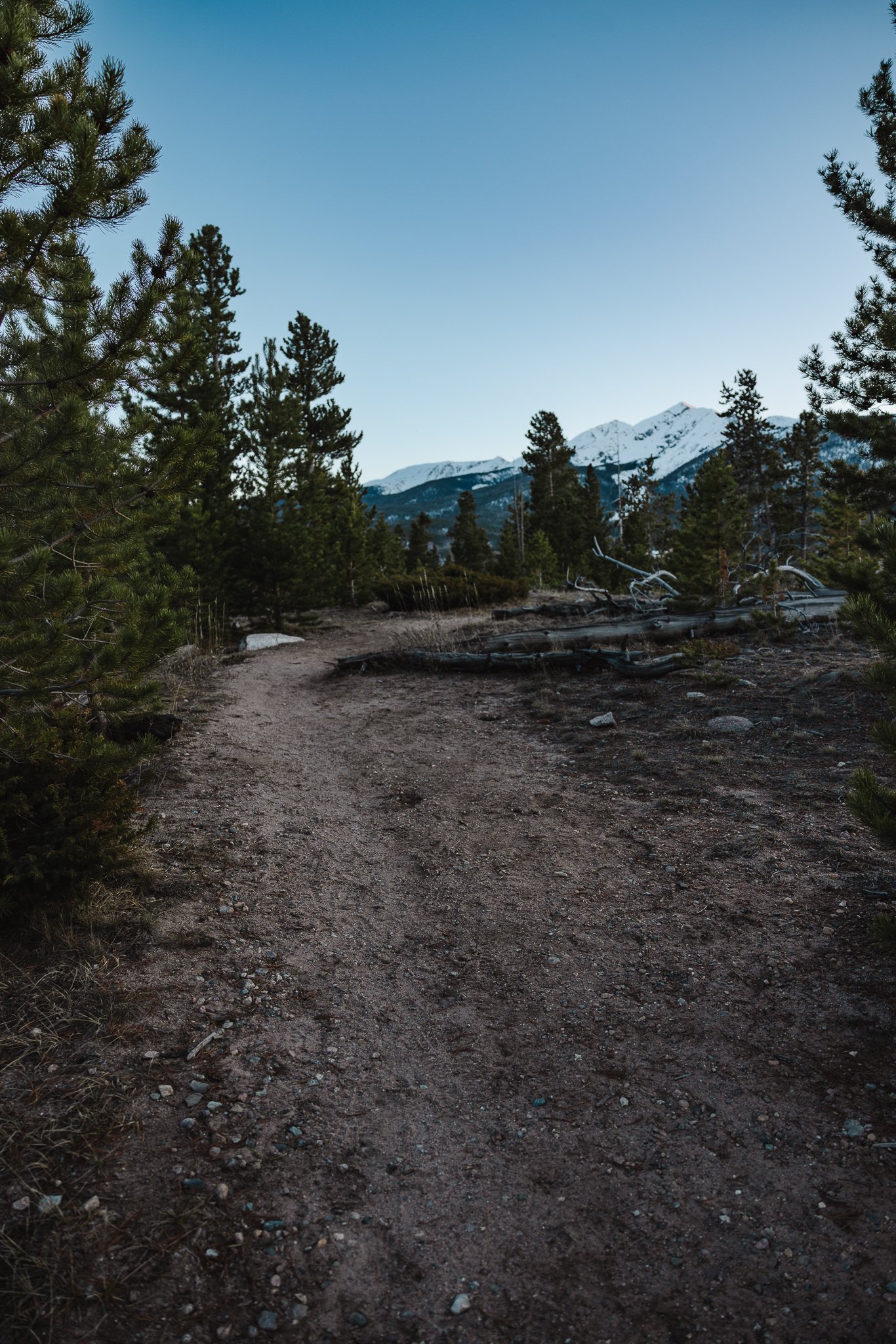
Breckenridge Colorado and Summit County alone have endless hiking trails. Most will be covered in snow and typically can’t be hiked until June. However, there’s three easy hikes you can do, snow or no snow that have great views, not much elevation gain, and are a fun way to spend an afternoon or evening in the Colorado mountains. They are even great trails for families with young children or couples looking for something that isn’t too strenuous. Below I’ll go over trail details, where to park, and how to access these trails. Alight lets do thisss.
Boreas Pass Service Road
How to get there
You’ll drive through downtown Breckenridge, all the way through town ending up on the south end. Take a left on Boreas Pass Road. Take this road all the way until you get to the dirt parking lot at the top.
Parking Coordinates: 39.47438, -106.04199
Best time to go
In the spring the parking at the top won’t be too filled up as most of the trails are covered in snow including the service road that you’ll hike on. However! In the summer and fall months this area gets pretty busy. Which is why spring is a great time to hike this trail as there are not many people around.

Trail Details
You can do the Bakers Tank Trailhead Loop which starts at the parking lot (look for the the trailhead on the left side) and is 2.5 miles. This trail will take you through the woods and pops out back on the road where the water tank is and then you walk back to the parking lot along the service road.
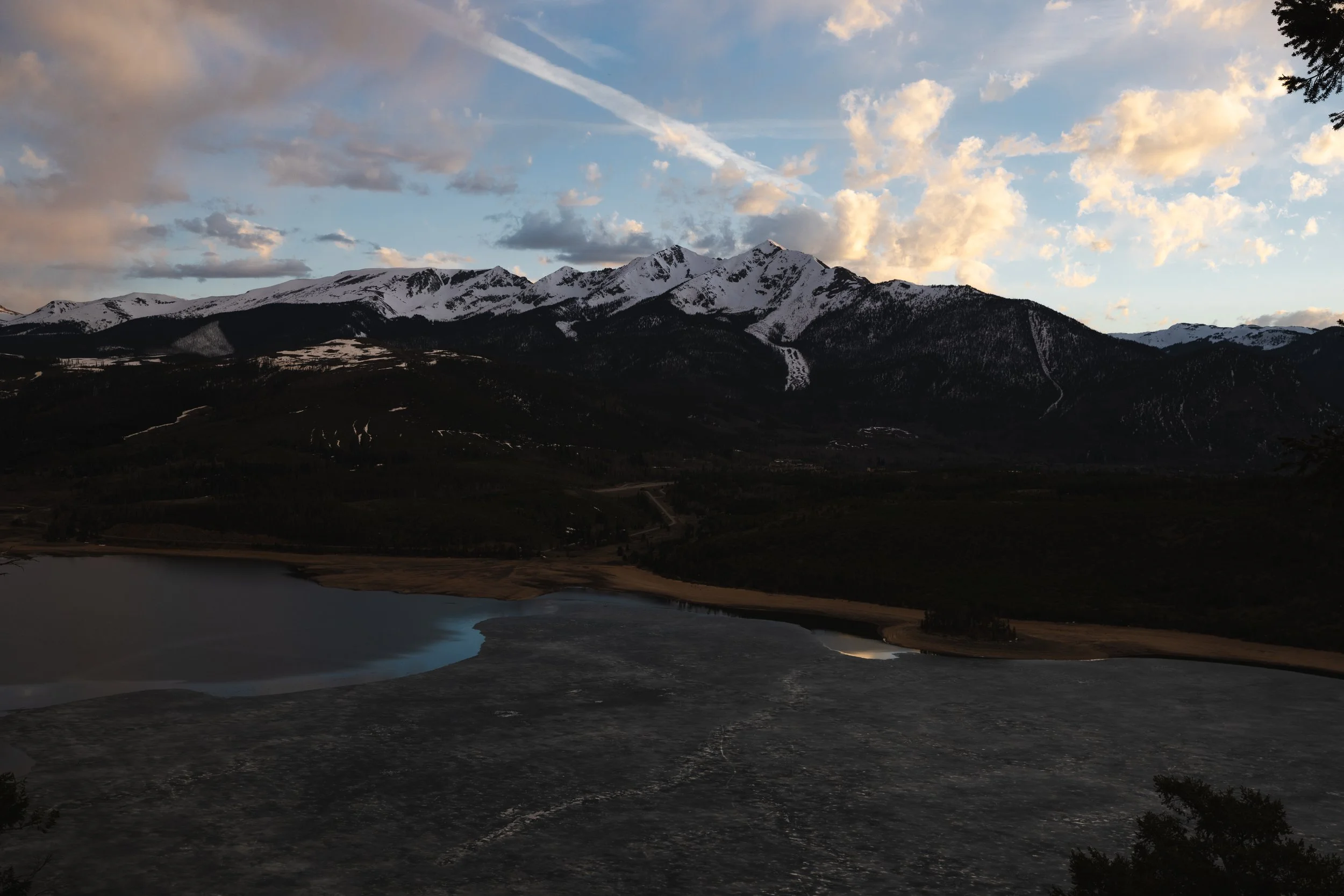
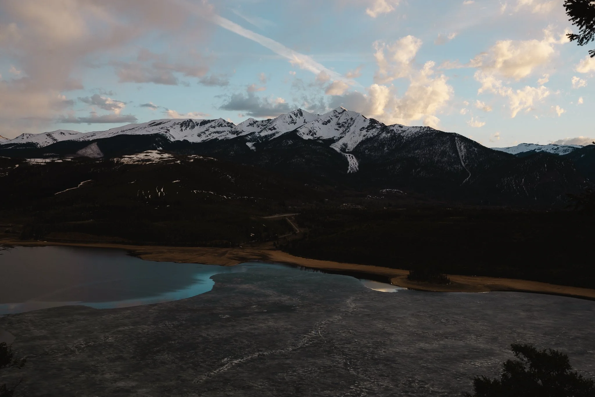
Or you can start walking from the parking lot along the road until you reach the overlook views. Walk along the road as far as you’d like until you feel like turning around. I like to catch a good sunset up here before walking back to my car. The views overlook most of the ten mile range and the town of Breck, which is what makes this such a cool spot.
Are Dogs Allowed
Dogs are allowed, on or off leash. Just make sure the clean up after your dog!

Sapphire Point
How to get there
Take Swan Mountain Road and at the top, about halfway, there will be a paved parking lot. Sometimes it will be filled, which in that case you might have to park along one of the lookout areas along Swan Mountain Road. But again, it is springtime and there are not as many people in Summit County! Parking coordinates below.
Coordinates: 39.58856, -106.04428


Trail Details
This is a pretty simple trail with some of the best views in Summit County overlooking Lake Dillon, Buffalo Mountain, Chief Mountain, and Red Peak. You might even catch a wedding ceremony going down as this is a popular spot for that. But again, in the spring there aren’t many people. Once parked, take the trail to the left, which will end up at a lookout with a stone wall. This is a great place for photos! Continue on the trail and it will loop back to the parking lot.
There will be some picnic tables towards the end of the Loop, making this spot a great place for an afternoon lunch.

Best time to go
Spring through fall, you can go in the winter, but the trail loop will be covered in snow. However, the walk to the main lookout should be ok year round. My favorite time to go is in the late afternoon-evening to catch the sun setting over the mountains.
Lake Dillon Lakeshore Perimeter Trail
How to get there and where to park
There’s a number of different entrances to this trail, as it goes around most of Lake Dillon. However I think the best place to park is near the Frisco Nordic Center. There is a number of parking spots in this area such as at the Frisco Skatepark or Baseball field . You’ll then want to download Alltrails and look for the Perimeter Trail sign, just past the Nordic Center.
Best time to go
Anytime of the day will work, but I like the afternoon/evening time. Spring through Fall is the only time I would go on this trail.
Trail Details
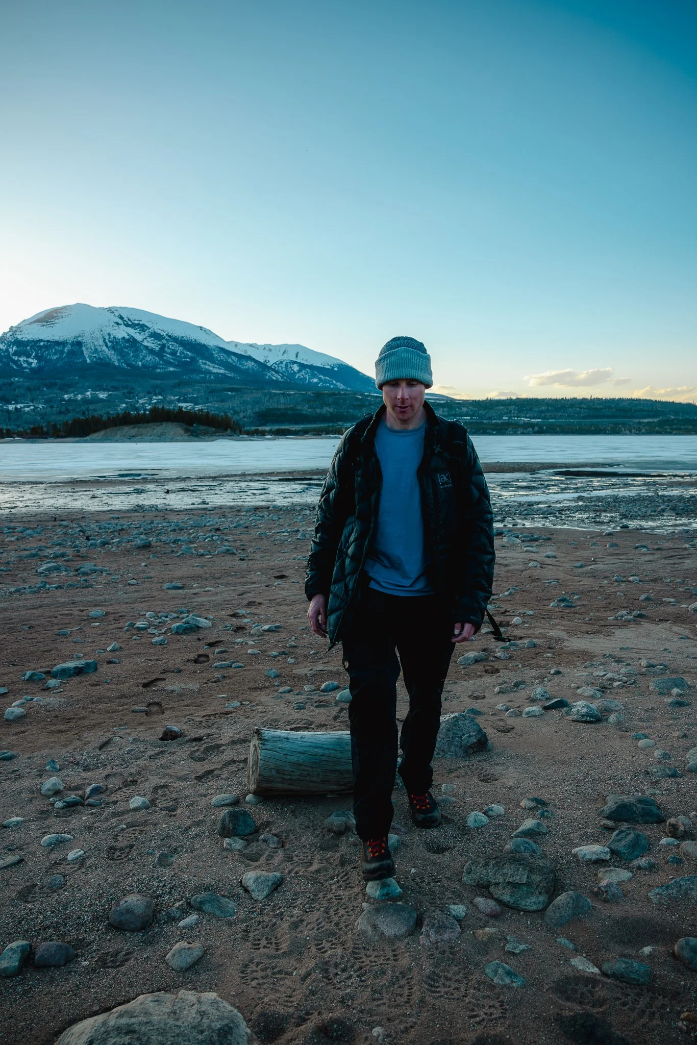
Once you’ve found the Perimeter Trail sign, you’ll walk along a narrow trail until you reach the lake. The trail veers to the right and eventually will take you to a beach area. Or, you can stay on the trail and keep hiking. The trail will go around the entire peninsula that you’re standing on. I like to only go part of the way as it is a 6.5 mile hike. Hike to one of the beaches and hang out. You can bring a blanket to sit on, catch a sunset, pack some food, and just enjoy the lake and mountains surrounding you. It’s one of the easiest hikes with some of the most captivating views.
Keep in mind during the spring, there may still be snow on parts of the trail. Not a problem because you can hike along the beach area until the trail is dry. Which is why I recommend using good hiking footwear to walk around on.

.One of my favorite areas of this trail is right around 2 miles in you’ll notice the Peninsula sticks out, and there’s a rock area where you can sit and hang out for a bit. You get a wide frame of view of the lake area and mountains. Kind of hard to explain so check out the photo below for a better idea. It will be just past the Peak One campground on the right. Please note, this trail is shared with mountain bikers so be aware that of this when hiking this loop. I honestly have never had any issues and bikers are always nice enough to communicate when they are close to you.
Are dogs allowed
Yep, I would leash up your dog on trail due to bikers, but it is ok off leash on the beach areas.

Just note, when traveling back to your car, stay on the Perimeter Loop trail and follow the trail signs. If you get lost, pull up the predownloaded map of the trail that you got on AllTrails for navigation. As long as you stay on the trail it will lead you right back to one of the parking lots near the Frisco Adventure Center.


What to Pack
Rain Jacket- Rain and Snow can pop up at anytime in the mountains during the spring.
Lightweight warm insulated jacket- Great for hiking, a lightweight insulated jacket is just that, lightweight.
Beanie/Ball Cap- Pack these, one for sun and one for colder mountain weather
Hiking footwear- Something with good traction and support. Stop by your local REI store to try different sizes and brands. I personally like LaSportiva.
Hiking Pants- Avoid cotton and I recommend anything lightweight with stretch material. My favorite hiking pants are made by Fjallraven.
Headlamp- If you plan on hiking in the evening, pack this just in case
Looking for other easier hikes to do in Colorado? Check out one of my favorites, Spiral Point in Aspen. It is a really cool place to visit in the Fall, when all the leaves are starting to change.

Colorado Hiking, a complete guide to Black Powder Pass Off Boreas Pass Road
One of the best things about Colorado in the spring, summer, and fall is the hiking. What seems like endless amounts of trails through out the state, there’s always a
Disclosure: When you buy something through the Affiliate product links I have created below, I earn a small commission. I only promote products and companies I support as well as believe in.
One of the best things about Colorado in the spring, summer, and fall is the hiking. What seems like endless amounts of trails through out the state, there’s always a new path to explore. I’ve always loved the history that the state has including old mining history and historic buildings that are still standing. One of my favorite hikes that I’ve done so far is Black Powder Pass, just outside of downtown Breckenridge.
The drive to the trailhead on Boreas Pass Road is one of the best parts, especially in the fall! In this post I’ll be going over directions to the trailhead, what the trail is like, best times of the year to hike, where to camp, and what to expect. Cool, letsss goooo.

What’s the story behind Black Powder Pass
Originally Boreas Pass was part of a railway that connected Breckenridge to Leadville crossing over the continental divide, seen at the trailhead. However by the late 1930’s with the decline of mining and the rise of cars and trucks, the railway became abandoned. It wasn’t until 1952, that a road was installed on Boreas Pass.

The group of small houses at the top called the Section house were built in 1881 and served as the housing for workers who maintained the section of the Boreas Pass Railway. Today the Section house is a hut for back country skiers, splitboarders, and people who snowshoe in the winter

How to get to the trailhead
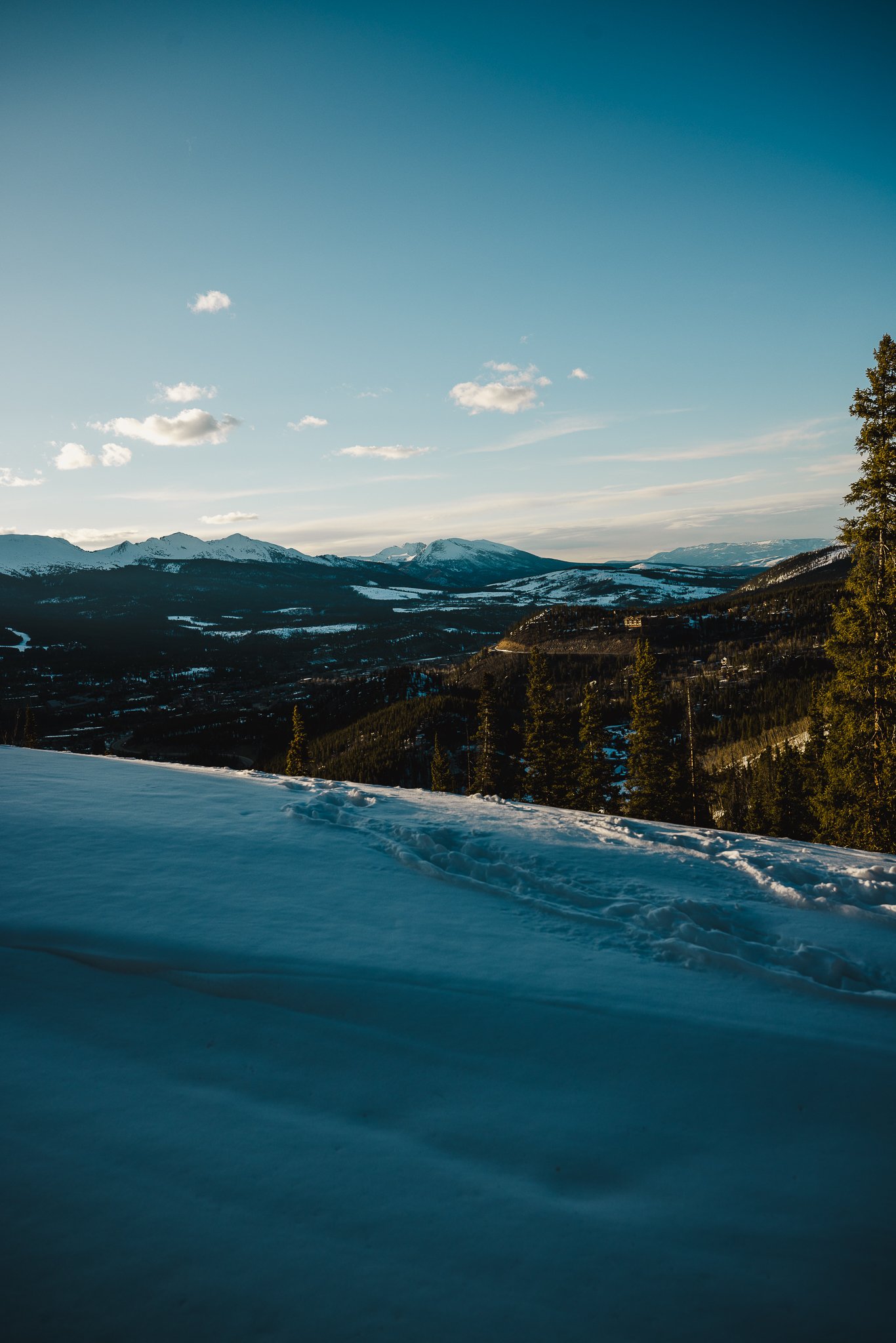
Depending on what direction you are driving from you’ll want to turn onto Boreas Pass Road and take that all the way to the top until you hit a dirt road, with a parking lot on your left. The road overlooks the ski resort and town as you drive up. There’s a couple pull offs, so grab a few photos before you drive to the trail! (the drive and hike are great for photography).
This road is somewhat narrow, with steep drop offs, so drive carefully! AWD isn’t required, but it helps to have. As you start driving on the dirt road you’ll go around a couple corners before you come up on a group of Aspens, from there you’ll go past Bakers Tank (A Giant Red water Tank) all the way to the top until you come up on a parking lot with an old railroad track.


The dirt road gets a lil bumpy towards the top, so drive slower.. Below I’ve listed major areas including downtown Breckenridge with distances and times. The two major highways you can take to get to the trail are either I70 or 285 South.

Trailhead Coordinates: 39.410310, -105.968420
Denver- 2 hours/87 Miles/140 km
Boulder- 2 hours and 20 minutes/96 miles/154 km
Downtown Breckenridge- 35 minutes/9 miles/14 km
Vail- 1 hour and 20 minutes/46 miles/74 km
Colorado Springs- 2 hours and 20 minutes/103 miles/166 Km


What should we pack
Water Bottle- Stay hydrated, especially at high altitudes! I like Hydro Flask because they keep your water cold for up to 24 hours.
Hiking Boots- Make sure you have good support and grip when out hiking. Colorado trails can get rocky, therefore I recommend a good pair of hiking boots such as Merrell! If you don’t like boots, they also make great hiking footwear.
Sunscreen-If you’re outside in Colorado, especially at a higher elevation it’s important to protect your skin. I like Sun Bum, based out of California, because it is none greasy.
Sunglasses- Often overlooked, if you plan on hiking during the day at high altitudes, you must have sunglasses. I’ve always been a fan of Dragon shades because they are easy on the wallet and have great depth perception and clarity.
Hat- Always pack a hat when going for a hike!, I love Burton hats, especially the tech, lightweight ones.
Backpack- I always like to hike with a bag to keep my water bottle, camera, and snacks for the trek, maybe even a beer or two for the top :) Burton makes amazing outdoor bags, backed with a lifetime warranty!


Any tips for hiking Black Powder Pass
Be careful when driving to the trailhead as there are steep drop offs with no guardrail on the dirt road, AWD and vehicles with good tires is a plus.
Bring a rain jacket and extra layers, even in the summer!
Visit in the Fall, mid to late September is one of the best times to be on Boreas Pass Road
Avoid weekends if you can due to more vehicles and people
Summer is a great time to catch the Wildflowers
You are at a higher elevation (11,482 Feet) take it easy and drink plenty of water!
Thunderstorms can pop up in the afternoon, however if the weather looks good, later afternoons in the evening are one of the best times to be on this trail!
Trail Stats
Trail Type: Out and Back
Distance: 3.4 miles/5.5 km
Difficulty: Moderate
Elevation Gain: 1,000 feet/305 meters
Dogs: On leash
Trail Time: Depending on speed and how long you stay at the top 2-3 hours
Is there parking and restrooms at the trailhead
There are no restrooms at the top, however there are two smaller parking lots on both sides of the road. Both lots are pretty empty on weekdays in the afternoon.
When is the best time to hike this trail
The best time to hike this trail is Late Spring to Early fall. Due to snowfall, Boreas Pass Road will close after the first parking lot at the top. You can still access the cabins in the winter by booking the Section House.
The busiest time of the year will be on weekends during the Fall when the leaves are changing. A lot of people will come up from Denver or the front range area to check out the fall foliage (leaf peepers). Try to come up midweek if you can as the fall colors are one of the best times of the year to hike in Summit County. Summers are great because of the wildflowers and there are a lot off Boreas Pass Road mid summer.
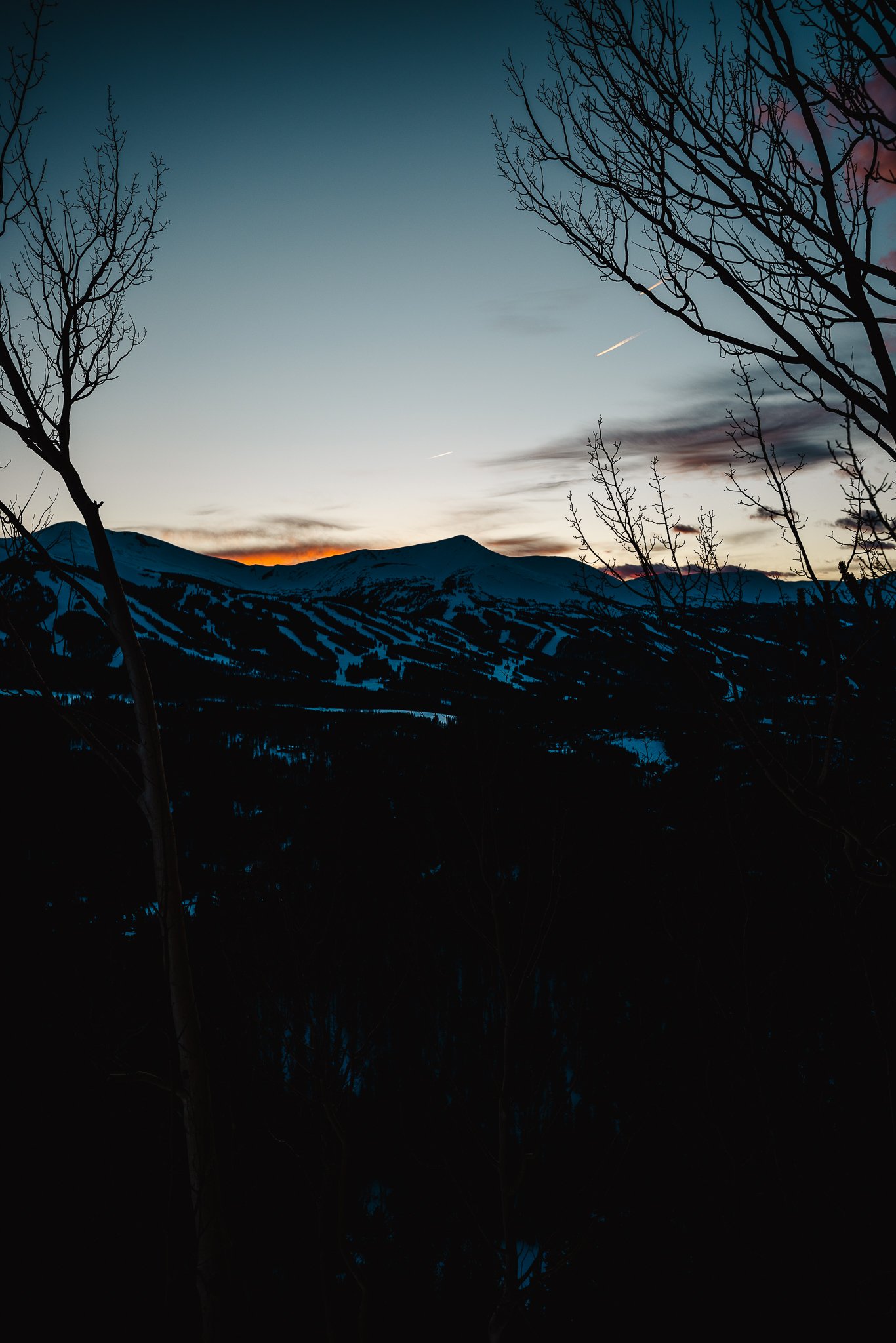
My favorite time of day to hike this trail is in the late afternoon-early evening because you get really cool golden light surrounding the hike and the sun is also not as intense as a mid day hike.


What is the trail like and is the hike difficult
The trailhead will be at the base of the historic Section House and old railroad tracks at the top of the continental divide. The continental divide is the line that runs from Alaska to Mexico and on one side water drains into the pacific ocean and on the other side the Atlantic ocean. The trail itself is part of the White River National Forest, but as you look to the right when driving up towards the top, that is the Pike National Forest.


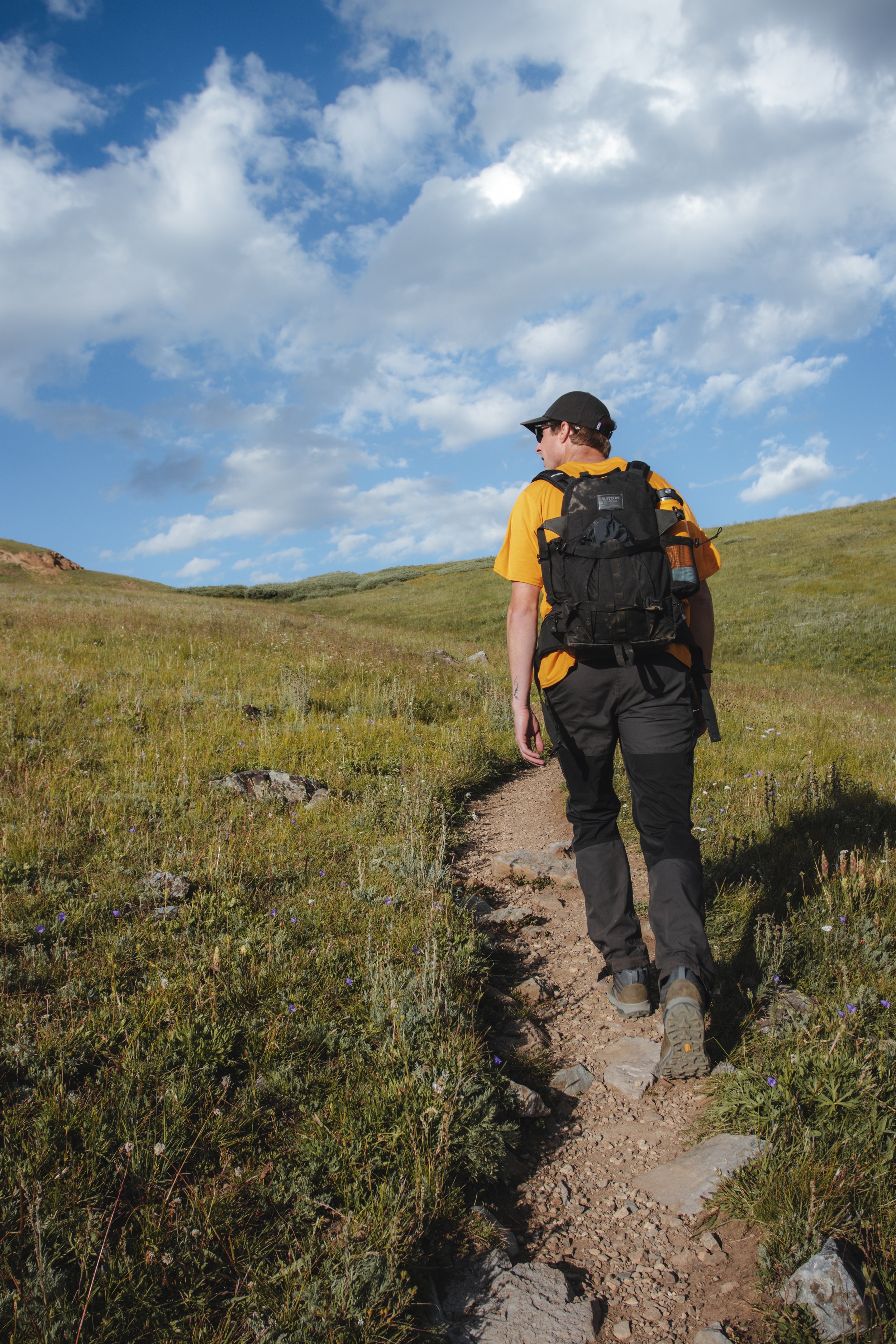
You’ll start your hike at the base of the Section House and is worth walking around and checking out! As you start hiking you’ll notice most of the trail is exposed with a couple of portions that walk through pine trees and dead tree stumps. The trail overall isn’t too strenuous and doesn’t take too much time either which is what I liked.
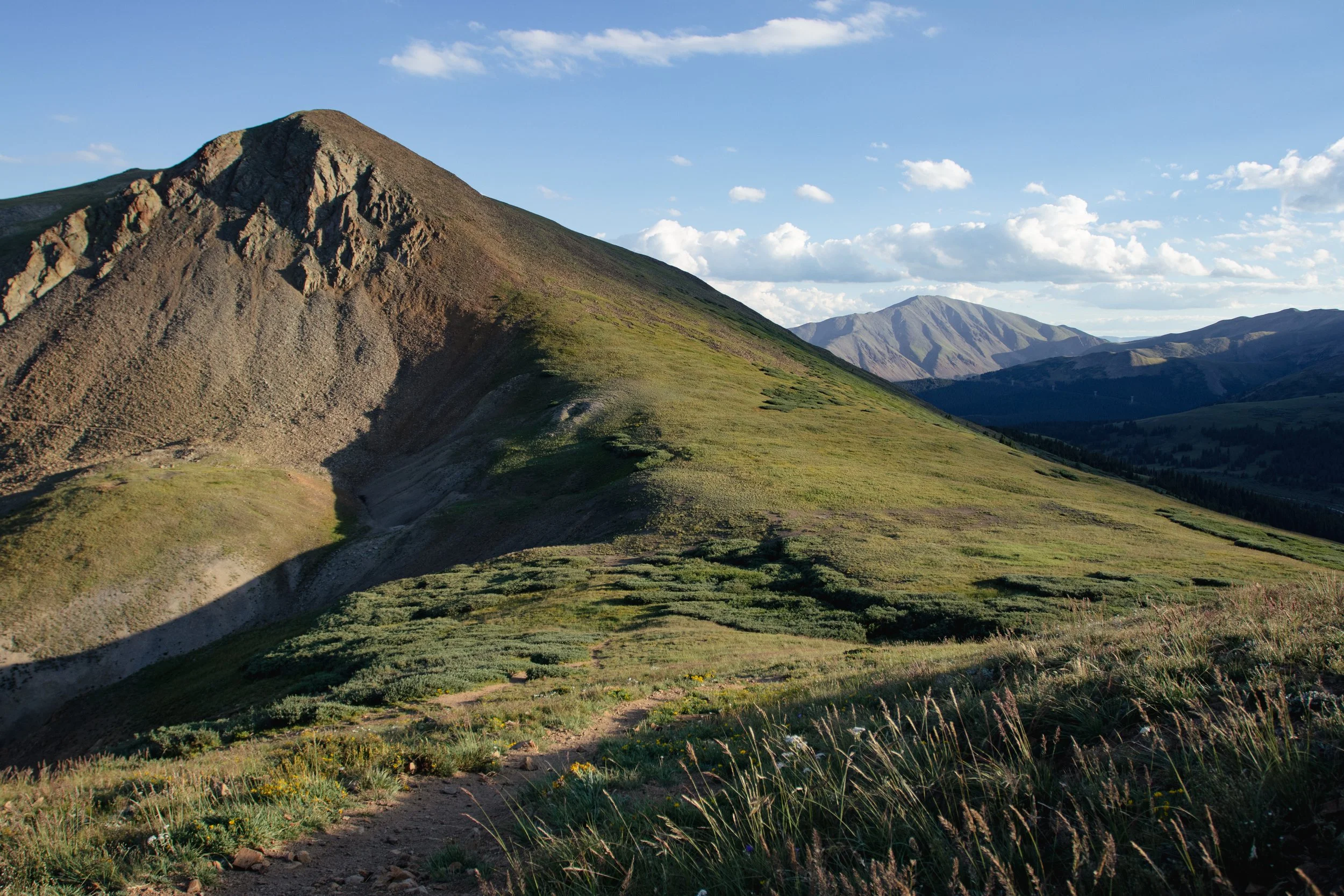
As you make your way towards the top, turn around and you’ll notice most of the ten mile range and next to it Mt Helen and Mt Quandary! It is one of the best views in the area in my opinion. Once above tree line, the trail itself is pretty straight to the top and you’ll be able to see Baldy Mountain to your left. Pack a lunch, snacks, or even a couple beers and enjoy the views at the peak.


At the peak you’ll also notice the backside of the mountain has views too, this portion overlooks the White River National Forest!

Is there camping in the area
Yep it is all dispersed camping (free), but with numbered camp sites. First come, first served and no public facilities. Pack out what you packed in and make sure to check weather and fire restrictions ahead of time.
Is the Boreas Pass Overlook worth checking out too
Yep, If you are in Breckenridge I highly recommend driving up to Boreas Pass road, and walking along the road. You can do this regardless of the time of year. Winter can be one of the best times to head up to Boreas Pass, as the town and surrounding peaks are covered in snow. Park in the first parking lot you arrive at and walk part of the road. In the fall walk along the road while checking out the fall colors or hang out and enjoy a sunset view over the ski resort.


That’s it for the Black Powder Pass Trail. If you’re vacationing in Breckenridge or even just passing through I highly recommend this hike! If you done this hike before or having any questions, leave a comment below. Looking for more information on outdoor trips, hikes, tips, and gear information, feel free to subscribe to our email list below! Thanks for reading the blog and I’ll see you on the next post.
Looking for other Colorado Hikes? Check out the Ptarmigan Lake trail, just outside of Buena Vista.


Meet Jeremiah
Growing up, I loved being outside. I took a lot of cool trips with my family, whether it was camping, going to the beach, road trips, and national parks. Even though I didn’t fully appreciate those experiences at the time, as I got older I started getting more into the outdoors and traveling, reconnecting with my past. The feeling of traveling or going somewhere new always seems to give a sense of excitement or adventure.
Snowboarding and boardsports in general have been a passion of mine for over 20 years. I always loved the culture that came with it; from local retail shops to magazines and videos, to riding with friends as well as geeking out on the latest gear, it’s all part of the experience. After working in snowboard/outdoor gear shops for the past decade along with traveling to different outdoor places, I decided to put all of that experience in digital form to inspire and connect with other people.